
By Scott H. Williams
At approximately 7:50pm on Tuesday, February 11, 2025, Southern Inyo Fire Protection District (SIFPD) received an emergency tone from dispatch followed by a report of a brush fire at the Borehole hot spring in Tecopa, California.
SIFPD responded to the scene with a crew of six volunteer firefighters, myself among them. By the time Inyo County Sheriff and SIFPD arrived at the Borehole, the fire had spread into a ring nearly 400 feet wide in the bulrush and saltgrass north of Tecopa Hot Springs Road and east of the Borehole pool and outflow channel.
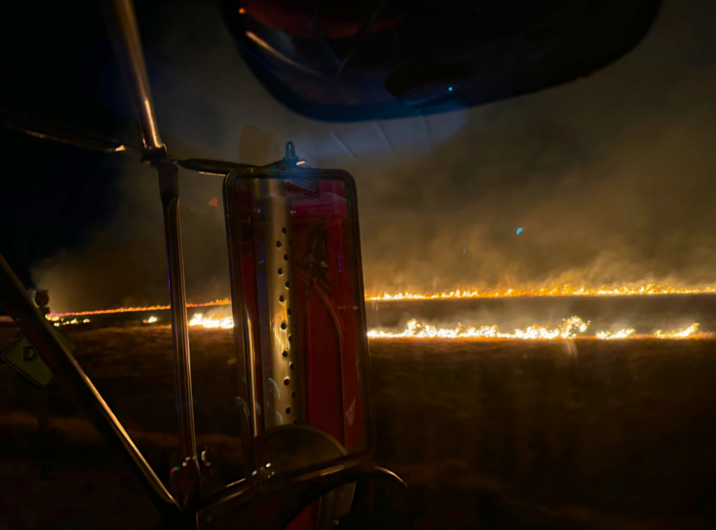
Borehole fire at 8:13pm February 11, 2025 when SIFPD arrived at the scene
A northwest wind was blowing at about 5 to 10 miles per hour, pushing the front of the fire south towards the road. SIFPD quickly established a defensive line along the roadway, spraying water from both the fire engine and water tender truck to extinguish the front in order to prevent the blaze from jumping the road. Utilizing this fire break was critical, since the wetland on the southwest side is a wide swath of dry rushes and grass extending to the southwest edge of Tecopa Hot Springs, where homes and businesses would be vulnerable. Meanwhile, the Sheriff’s deputy found three people still soaking in the hot spring, apparently watching the fire as it rapidly spread across the marsh. The deputy collected their information and asked them to vacate the scene.
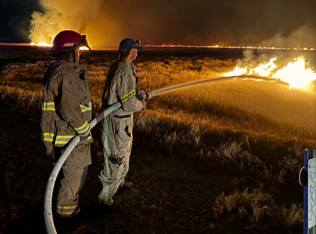
Volunteer firefighters Angie and Danny dousing flames from Tecopa Hot Springs Road
By the time the fire front along the road was fully extinguished, most of the north and east sides of the wetland had been scorched.
The fire had backed against the wind towards the Borehole and in some places jumped the springbrook on the western edge of the marsh. Fortunately, the wetland vegetation is hemmed in by bare alkali mud hills that helped to contain the fire from spreading out of control. SIFPD stifled the remaining spot fires with hand tools, and by 10:15pm the fire was fully extinguished.
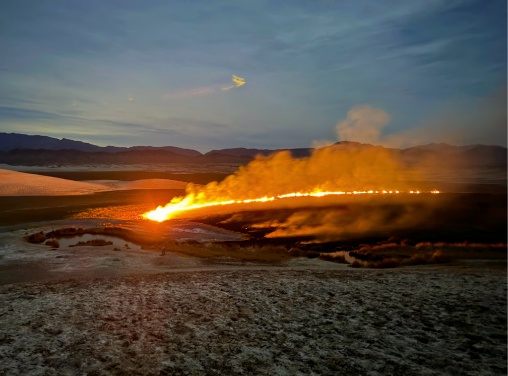
Borehole fire at 9:12pm seen from the mud hills west of the hot spring
The burned marsh adjacent to the Borehole illuminated by the light of a full moon at 9:59pm, moments after the fire was fully extinguished
The history of the Borehole (sometimes called the “mud springs” by Tecopa locals because of the slick bentonite clay that some bathers take from the sides of the pool and apply to their skin like a spa treatment) is a paradox of human environmental meddling. This “spring” is not at all natural.
The name Borehlole hints at its origin story: it was created by accident decades ago when mineral exploration drillers encountered hot groundwater under so much pressure that it caused a blowout underneath the drill rig.
The drillers attempted to stop the flow by backfilling the borehole but ultimately gave up and abandoned the site, leaving the new manmade spring to continue flowing out across the surface of the land.
This new flow reduced pressure in the surrounding system of hot springs, causing ongoing degradation of habitat as nearby springs went dry. Yet, in an ironic turn of events, the water released by this blunder has contributed to the creation of a lush marshland that sustains one of exactly two remaining wild populations of the endangered Amargosa Vole, whose sole habitat is the three-square bulrush adjacent to the warm water of the outflow channel.
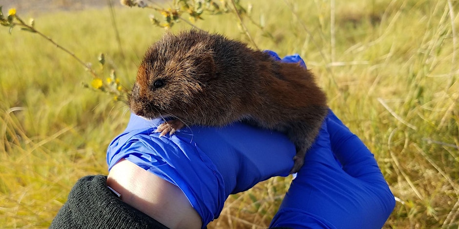
Amargosa vole (Microtus californicus scirpensis)
The vole is a small wetland mammal endemic to two wetlands along the Amargosa Wild and Scenic River in Shoshone and Tecopa. Biologists believe that the Amargosa Vole evolved from its close genetic relative the California vole as the Amargosa River watershed gradually became geographically isolated from its larger range and population. The voles are extremely elusive, never leaving the dense thatch of dead three-square bulrush that collects below the living bulrushes in and around springs.
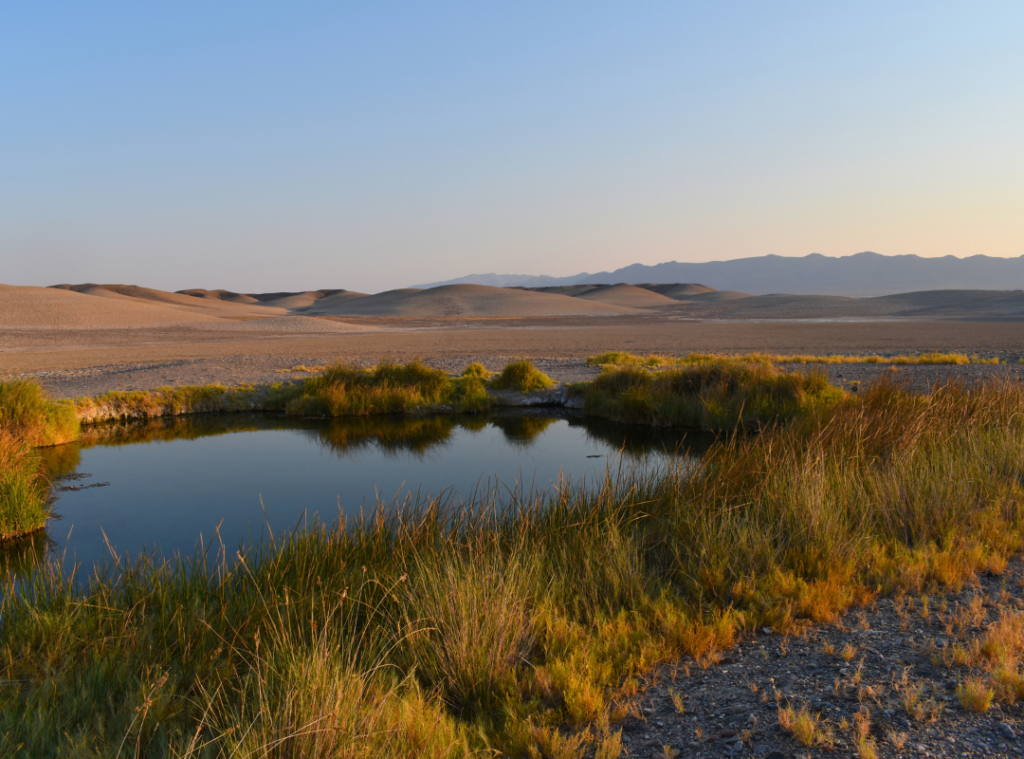
The Borehole source pool in September 2024
People, too, were drawn to the new spring on the edge of Tecopa.
Its waters rise rapidly along a fault from a deep carbonate aquifer, the same source tapped by the nearby hot spring resorts. The Borehole boasts some additional perks, though: views of the Resting Spring range and the Tecopa marsh, the clay mud, and free access, since it is located on public land managed by the Bureau of Land Management (BLM).
In recent years, recreational use of the Borehole has increased significantly. In spite of signage explaining the sensitivity of the marsh and the endangered voles, people regularly light campfires, camp, and defecate near the water. In 2021, Center for Biological Diversity (CBD) issued a Notice of Intent to Sue BLM over mismanagement of the Borehole, citing that “the BLM has also failed to control impacts from recreation despite clear indications that it is impacting the vole and its habitat.”
On the morning of February 12, I met a BLM Fire investigator at the burn site.
Nearly all of the marsh north of Tecopa Hot Springs Road was completely burned, an area of 9.0 acres.
Only a few small stands of bulrush around the Borehole itself and at the edge of the springbrook were spared. The investigator found evidence that indicated the fire’s point of origin was near the center of the marsh – not at the edge of the Borehole where most recreation takes place. As of February 20, the fire investigation is ongoing.
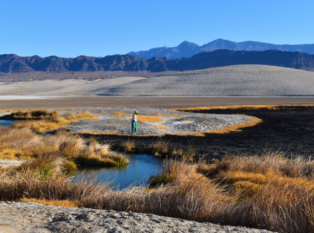
The Borehole Spring at 8:30am February 12
On February 13, Tecopa received 0.59 inches of rain, marking the beginning of a cycle of natural recovery for the marsh. The bulrushes, being rhizomatous, will rebound quickly, sprouting out of the still-wet soil where their roots were protected from burning. However, fire disturbance creates openings for opportunistic invasive plants to establish, so people will need to play an active role in monitoring and restoration in order to ensure a healthy recovery.
The federally endangered Amargosa vole was certainly impacted. Biologists will need to search for carcasses to estimate the immediate impact to the vole population.
Regardless of how many voles may have been lost to the fire itself, their habitat was catastrophically reduced in a very short period of time, which will certainly impact their viability.
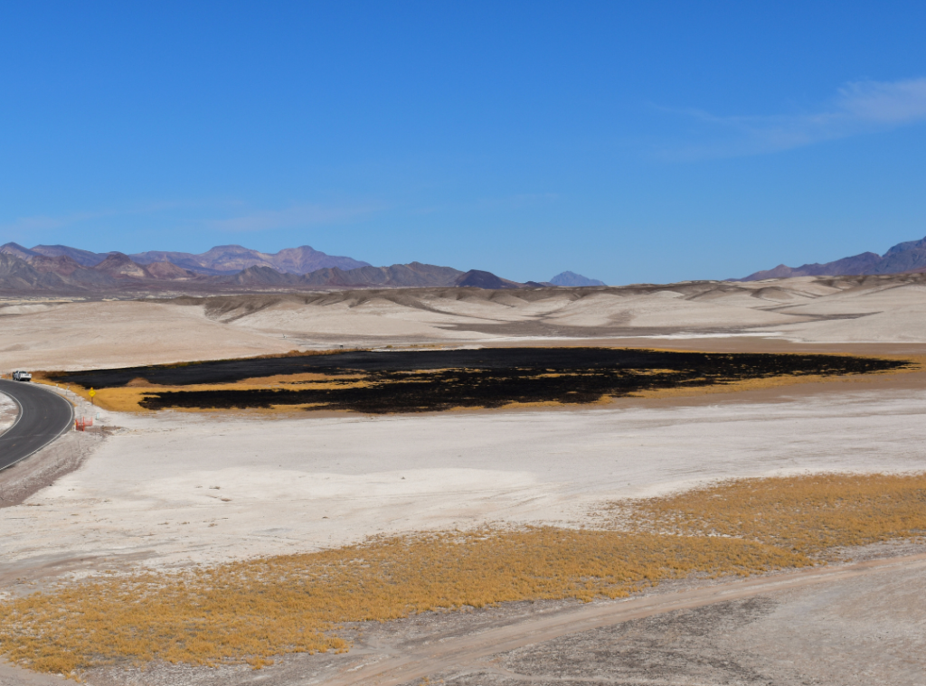
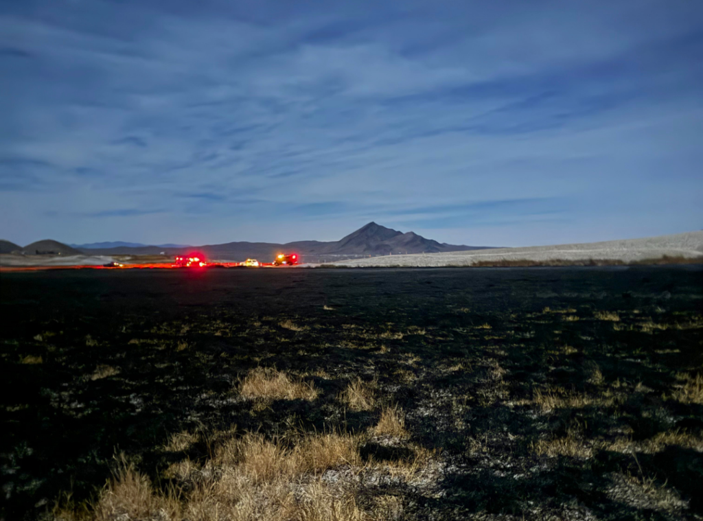
Borehole fire burn area, view from the south
Because of the ongoing BLM Fire investigation, the threat of invasive plants establishing in the burn area, and the heightened stress on the voles caused by this fire, it is critical that people avoid the area until it can be thoroughly assessed. CBD and Amargosa Conservancy submitted a letter to the Barstow BLM field office urging them to “take certain steps to protect public lands resources and ensure rapid and meaningful restoration in response to this fire, including the emergency closure of the Borehole Spring recreation site.”
The community of Tecopa did not hesitate to respond with the full extent of its resources and support.
SIFPD is a small, isolated, 100% volunteer emergency response team. Those who know Tecopa know that it is not a wealthy community, and the same is true for its fire department. Yet without this rapid local response, far more of the Tecopa marsh and possibly structures in Tecopa Hot Springs would certainly have been lost to the fire. This demonstration of selflessness and cooperation against the odds with limited resources are cause for hope, optimism, and pride.
Please consider donating to Southern Inyo Fire Protection District so that we can continue to promptly respond to future emergencies in this portion of the Amargosa River watershed.
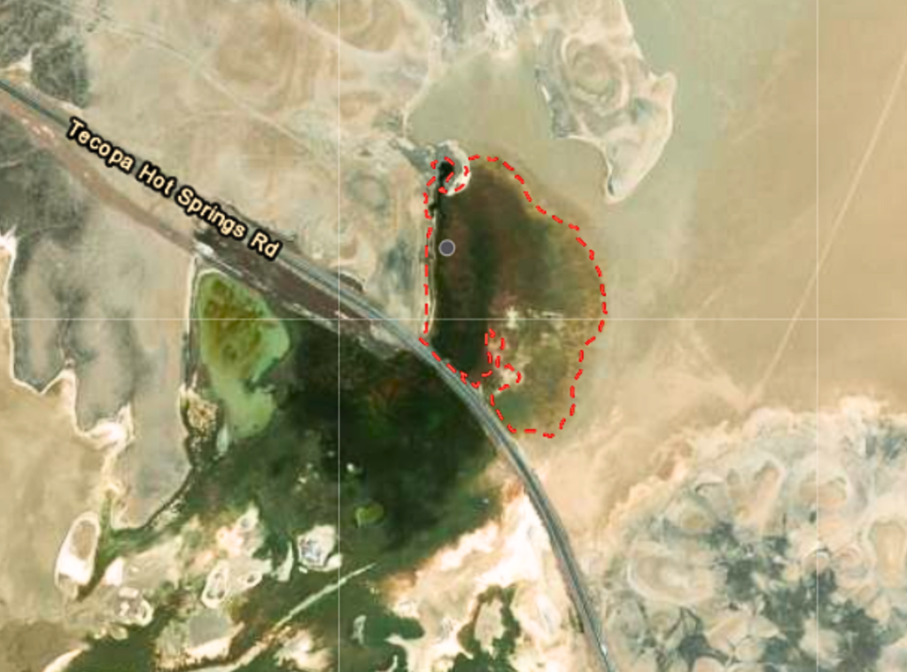
BLM map of the 9.0-acre Borehole fire
Over the coming weeks and months, Amargosa Conservancy will assist in convening emergency response calls with state and federal agencies, nonprofit partners, and researchers to chart a course of action for restoring the critical vole habitat lost in this fire. Hands-on site restoration activities may be necessary over the coming months, and we will certainly be relying on volunteers to lend a hand during these events.
Stay tuned for more updates, and please also consider a donation to Amargosa Conservancy today to support our role as a longstanding partner in the fight to save the Amargosa vole from extinction.
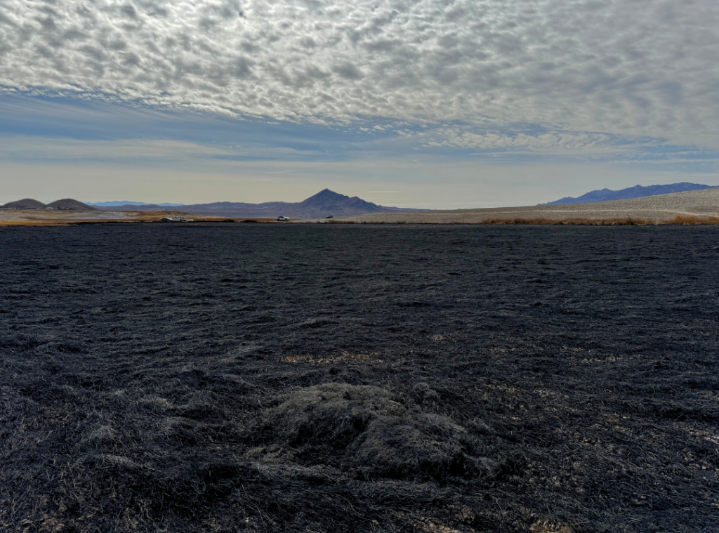
View south across the burned marsh surrounding the Borehole spring, looking towards Tecopa Hot Springs Road and Tecopa Peak